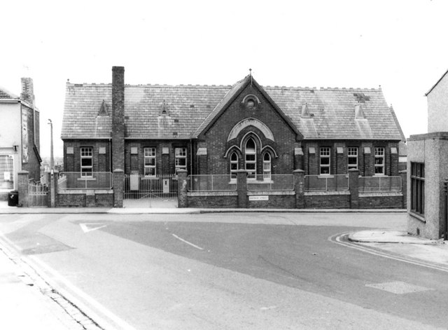
Clifton Street Schools, Radnor Street
Introduction
The photograph on this page of Clifton Street Schools, Radnor Street by P L Chadwick as part of the Geograph project.
The Geograph project started in 2005 with the aim of publishing, organising and preserving representative images for every square kilometre of Great Britain, Ireland and the Isle of Man.
There are currently over 7.5m images from over 14,400 individuals and you can help contribute to the project by visiting https://www.geograph.org.uk

Image: © P L Chadwick Taken: Unknown
Facing the end of Clifton Street, with access from both Radnor Street and William Street, Clifton Street Schools comprised both infant and junior schools. They were opened on this site in stages, over a short period of years commencing in 1884. In 1950 there was considerable enlargement and alterations. Over the central windows is engraved "Clifton Street Schools". On the front boundary wall is a street name sign for Radnor Street. When photographed the schools were still in use. Some years ago they closed and pupils went to the newly built Robert Le Kyng Primary School in nearby Westcott Street. Today the buildings have another use, as can be seen in the recent photograph of Brian Robert Marshall:- Image The building externally has not changed much, except that the brick built boundary wall with metal railings, that used to front Radnor Street, has been demolished so as to provide car parking.

