2009 : Crossroads with traffic lights
Introduction
The photograph on this page of 2009 : Crossroads with traffic lights by Maurice Pullin as part of the Geograph project.
The Geograph project started in 2005 with the aim of publishing, organising and preserving representative images for every square kilometre of Great Britain, Ireland and the Isle of Man.

There are currently over 7.5m images from over 14,400 individuals and you can help contribute to the project by visiting https://www.geograph.org.uk
2009 : Crossroads with traffic lights
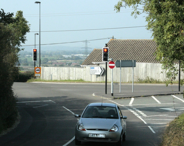
Image: © Maurice Pullin Taken: 19 Sep 2009
Taken about 4 years after Image Either the traffic lights have been put in since, or Mr. ChurchCrawler had them removed specially for his image. Westerleigh is at the bottom of the hill beyond. Further over much of the farmland around Yate and Chipping Sodbury has been taken for housing estates. The B4465 takes a turn to the right here.
Images are licensed for reuse under creativecommons.org/licenses/by-sa/2.0
Image Location
Latitude
51.511309
Longitude
-2.426912