Pulborough: A283 Stopham Road railway bridge
Introduction
The photograph on this page of Pulborough: A283 Stopham Road railway bridge by Nigel Cox as part of the Geograph project.
The Geograph project started in 2005 with the aim of publishing, organising and preserving representative images for every square kilometre of Great Britain, Ireland and the Isle of Man.

There are currently over 7.5m images from over 14,400 individuals and you can help contribute to the project by visiting https://www.geograph.org.uk
Pulborough: A283 Stopham Road railway bridge
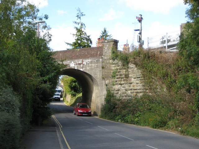
Image: © Nigel Cox Taken: 17 Sep 2009
Having carried out a risk assessment and scuttled through the bridge from the other side, Image, this is the eastern side. The barely visible height restriction plate reads 14' 6" between the verticals of the H-shaped width indicator. Looking back at the other photograph I see that there is an identical height restriction plate on the other side although most of the H-shaped metal bars have dropped off. Note the old semaphore signal on the railway at the far end of the down line platform of Pulborough station.
Images are licensed for reuse under creativecommons.org/licenses/by-sa/2.0
Image Location
Latitude
50.956695
Longitude
-0.517504