The Cornmill becomes Hardy's House
Introduction
The photograph on this page of The Cornmill becomes Hardy's House by David Lally as part of the Geograph project.
The Geograph project started in 2005 with the aim of publishing, organising and preserving representative images for every square kilometre of Great Britain, Ireland and the Isle of Man.

There are currently over 7.5m images from over 14,400 individuals and you can help contribute to the project by visiting https://www.geograph.org.uk
The Cornmill becomes Hardy's House
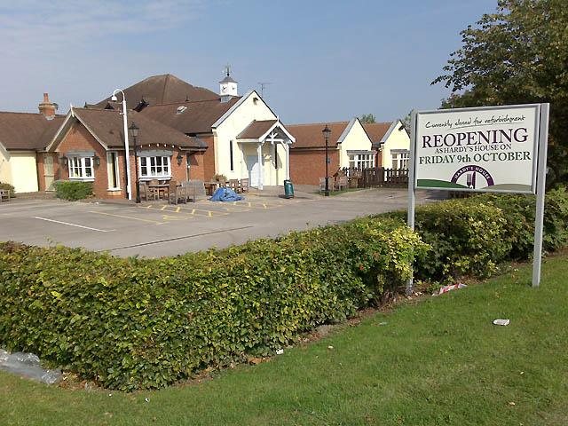
Image: © David Lally Taken: 19 Sep 2009
The Cornmill, a former Hardy Hansons pub, is having the Greene King work-over. It looks like it will be (ironically?) named Hardy's House. Update after opening: It turned-out that it is still called The Cornmill and "Hardy's House" appears to be a new branding.
Images are licensed for reuse under creativecommons.org/licenses/by-sa/2.0
Image Location
Latitude
52.904608
Longitude
-1.243487