Widened railway bridge, Carrickfergus (1)
Introduction
The photograph on this page of Widened railway bridge, Carrickfergus (1) by Albert Bridge as part of the Geograph project.
The Geograph project started in 2005 with the aim of publishing, organising and preserving representative images for every square kilometre of Great Britain, Ireland and the Isle of Man.

There are currently over 7.5m images from over 14,400 individuals and you can help contribute to the project by visiting https://www.geograph.org.uk
Widened railway bridge, Carrickfergus (1)
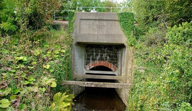
Image: © Albert Bridge Taken: 19 Sep 2009
The stone part of the bridge dates from the opening of this part of the Belfast – Larne Harbour line by the Carrickfergus and Larne Railway in 1862. The concrete part was built by the LMS (NCC) when the line was doubled, to Whitehead, in 1929. The bridge is across the outlet from the old mill ponds Image See also Image
Images are licensed for reuse under creativecommons.org/licenses/by-sa/2.0
Image Location
Latitude
54.718532
Longitude
-5.80268