Dollis Road
Introduction
The photograph on this page of Dollis Road by Martin Addison as part of the Geograph project.
The Geograph project started in 2005 with the aim of publishing, organising and preserving representative images for every square kilometre of Great Britain, Ireland and the Isle of Man.

There are currently over 7.5m images from over 14,400 individuals and you can help contribute to the project by visiting https://www.geograph.org.uk
Dollis Road
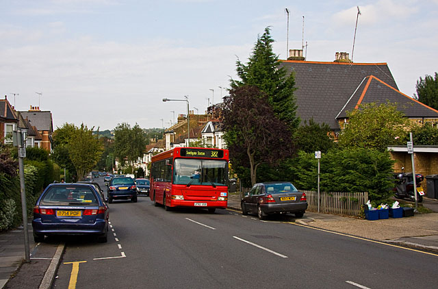
Image: © Martin Addison Taken: 20 Sep 2009
Looking down into the Dollis Valley from near the junction with Nether Street. Pavement parking has been instituted on both sides of the road in order to allow for an easy flow of traffic on this steep hill. Arriva PDL86 storms up the hill on a 382 service from Mill Hill East Station to Southgate Station. Recently repainted, it has lost the Arriva cream cowhorns and carries the fleetname in small letters above the drivers window. Compare this with a sister vehicle in Image Several London bus operators are moving towards a simple all over red scheme, presumably to reduce costs.
Images are licensed for reuse under creativecommons.org/licenses/by-sa/2.0
Image Location
Latitude
51.604349
Longitude
-0.197445