The changing face of Stafford
Introduction
The photograph on this page of The changing face of Stafford by Simon Huguet as part of the Geograph project.
The Geograph project started in 2005 with the aim of publishing, organising and preserving representative images for every square kilometre of Great Britain, Ireland and the Isle of Man.

There are currently over 7.5m images from over 14,400 individuals and you can help contribute to the project by visiting https://www.geograph.org.uk
The changing face of Stafford
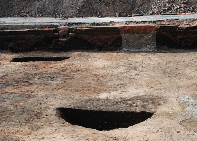
Image: © Simon Huguet Taken: 19 Aug 2009
The Tipping Street car park has been closed and archaeological surveys are being carried out pending the development of a new complex of County Council Buildings. This picture shows what are probably the cellars of houses around Apple Tree Court - one of the courtyards that grew up behind the facades of many C18th and C19th town streets. Each house in such a court would have probably have housed several families or a family and lodgers and were where many of the working class people of the day lived. The darker earth areas being excavated may be old rubbish pits.
Images are licensed for reuse under creativecommons.org/licenses/by-sa/2.0
Image Location
Latitude
52.805576
Longitude
-2.115068