Rickmansworth Road
Introduction
The photograph on this page of Rickmansworth Road by Martin Addison as part of the Geograph project.
The Geograph project started in 2005 with the aim of publishing, organising and preserving representative images for every square kilometre of Great Britain, Ireland and the Isle of Man.

There are currently over 7.5m images from over 14,400 individuals and you can help contribute to the project by visiting https://www.geograph.org.uk
Rickmansworth Road
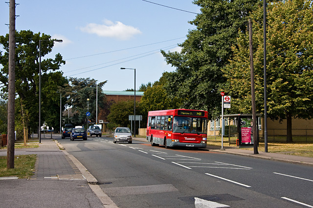
Image: © Martin Addison Taken: 12 Sep 2009
The A404 seen at Crossway, looking towards Northwood Hills Circus. A bus for Harrow on the H11 route pulls in to drop off a passenger. The brick building behind the trees is the church of St. Edmund the King. It is here, at the kink in the road, that we move from the Borough of Harrow into the Borough of Hillingdon and the road changes its name to Pinner Road.
Images are licensed for reuse under creativecommons.org/licenses/by-sa/2.0
Image Location
Latitude
51.600465
Longitude
-0.401049