Flood relief works at Long Itchington (3)
Introduction
The photograph on this page of Flood relief works at Long Itchington (3) by Andy F as part of the Geograph project.
The Geograph project started in 2005 with the aim of publishing, organising and preserving representative images for every square kilometre of Great Britain, Ireland and the Isle of Man.

There are currently over 7.5m images from over 14,400 individuals and you can help contribute to the project by visiting https://www.geograph.org.uk
Flood relief works at Long Itchington (3)
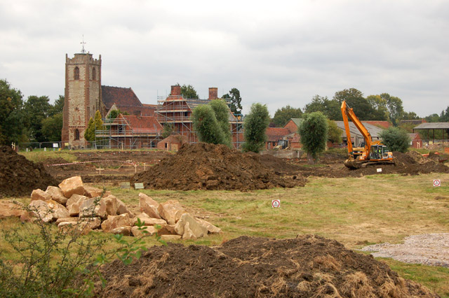
Image: © Andy F Taken: 15 Sep 2009
Looking northeast at works to improve flood defences at Long Itchington. See [http://www.geograph.org.uk/photo/1111755] for a view before the works; see [http://www.geograph.org.uk/photo/655690] for a view of a flood at this point. The course of the River Itchen is being diverted 25 metres south to make room for a wider higher embankment to protect the village. As well as realignment of the river, the scheme includes repairs to concrete flood defence walls and the establishment of a wetland nature reserve. The scheme is being carried out by the Environment Agency and work started in August 2009.
Images are licensed for reuse under creativecommons.org/licenses/by-sa/2.0
Image Location
Latitude
52.282597
Longitude
-1.397925