The Bakers Arms, Bugbrooke
Introduction
The photograph on this page of The Bakers Arms, Bugbrooke by Stephen McKay as part of the Geograph project.
The Geograph project started in 2005 with the aim of publishing, organising and preserving representative images for every square kilometre of Great Britain, Ireland and the Isle of Man.

There are currently over 7.5m images from over 14,400 individuals and you can help contribute to the project by visiting https://www.geograph.org.uk
The Bakers Arms, Bugbrooke
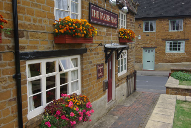
Image: © Stephen McKay Taken: 13 Sep 2009
Village pub on High Street - unusually for a rural hostelry these days, the emphasis here is very much on drinking and traditional pub games rather than food. The building was originally the village bakery.
Images are licensed for reuse under creativecommons.org/licenses/by-sa/2.0
Image Location
Latitude
52.209862
Longitude
-1.010642