The Metropolitan Line
Introduction
The photograph on this page of The Metropolitan Line by Martin Addison as part of the Geograph project.
The Geograph project started in 2005 with the aim of publishing, organising and preserving representative images for every square kilometre of Great Britain, Ireland and the Isle of Man.

There are currently over 7.5m images from over 14,400 individuals and you can help contribute to the project by visiting https://www.geograph.org.uk
The Metropolitan Line
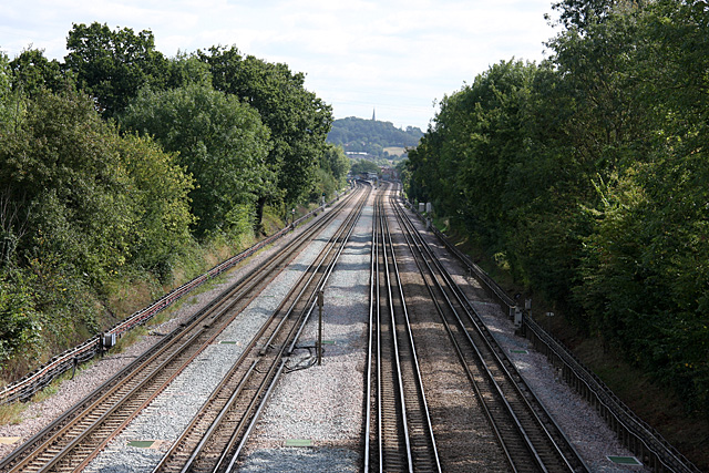
Image: © Martin Addison Taken: 12 Sep 2009
Looking from Marsh Road towards North Harrow station, visible on the curve in the distance. The tracks on the left are for stopping services whilst those on the right are used by fast trains. On the horizon the spire of St. Mary's in Harrow-on-the-Hill can be seen.
Images are licensed for reuse under creativecommons.org/licenses/by-sa/2.0
Image Location
Latitude
51.589097
Longitude
-0.372144