View of Herne Bay from the top of Beacon Hill
Introduction
The photograph on this page of View of Herne Bay from the top of Beacon Hill by Robert Lamb as part of the Geograph project.
The Geograph project started in 2005 with the aim of publishing, organising and preserving representative images for every square kilometre of Great Britain, Ireland and the Isle of Man.

There are currently over 7.5m images from over 14,400 individuals and you can help contribute to the project by visiting https://www.geograph.org.uk
View of Herne Bay from the top of Beacon Hill
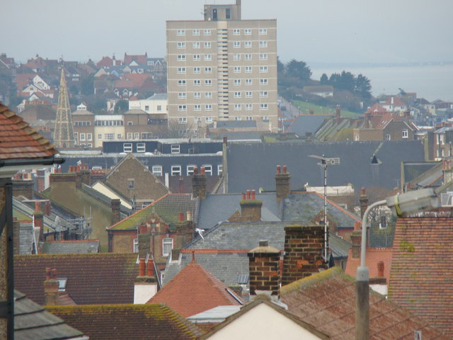
Image: © Robert Lamb Taken: 14 Dec 2008
Beacon Hill rises up on the cliff top high above the sea and promenade below the cliff, giving this splendid view of Herne Bay at the top of the hill. The tower block is the one that features in Philip Perry's Image (Central Parade can just be seen running alongside it to the right of it), whilst the church spire on the left is that on the High Street. The houses on higher ground behind the tower block are on and around Central Parade as it passes Herne Bay seafront and out into Hampton. View taken looking west towards the town centre.
Images are licensed for reuse under creativecommons.org/licenses/by-sa/2.0
Image Location
Latitude
51.372421
Longitude
1.131048