Warrior pub
Introduction
The photograph on this page of Warrior pub by Chris Lordan as part of the Geograph project.
The Geograph project started in 2005 with the aim of publishing, organising and preserving representative images for every square kilometre of Great Britain, Ireland and the Isle of Man.

There are currently over 7.5m images from over 14,400 individuals and you can help contribute to the project by visiting https://www.geograph.org.uk
Warrior pub
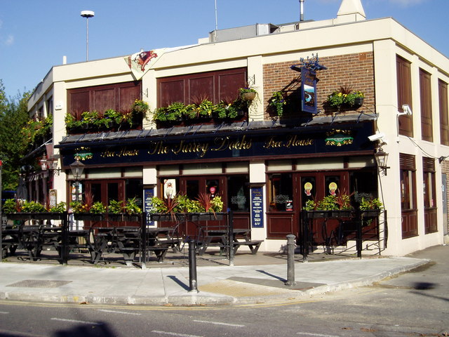
Image: © Chris Lordan Taken: 30 Oct 2007
At 185 Lower Road junction with Redriff Road, Rotherhithe Street, SE16. Built the same time as the Osprey Estate (to its right) and was originally at 209, Lower Road junction with Maynard Road - opposite Cope Street. The original pub was built in 1862 and named the Manor Beer Shop.
Images are licensed for reuse under creativecommons.org/licenses/by-sa/2.0
Image Location
Latitude
51.489221
Longitude
-0.049734