Delamere Terrace
Introduction
The photograph on this page of Delamere Terrace by Martin Addison as part of the Geograph project.
The Geograph project started in 2005 with the aim of publishing, organising and preserving representative images for every square kilometre of Great Britain, Ireland and the Isle of Man.

There are currently over 7.5m images from over 14,400 individuals and you can help contribute to the project by visiting https://www.geograph.org.uk
Delamere Terrace
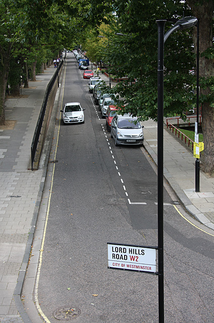
Image: © Martin Addison Taken: 25 Aug 2009
Seen from the corner at which it becomes Lord Hills Road. The Grand Union Canal is behind the trees on the left, the raised pavement indicating that it is significantly higher than the road.
Images are licensed for reuse under creativecommons.org/licenses/by-sa/2.0
Image Location
Latitude
51.522175
Longitude
-0.187387