Great Yeldham: Hope Strict Baptist Chapel
Introduction
The photograph on this page of Great Yeldham: Hope Strict Baptist Chapel by Nigel Cox as part of the Geograph project.
The Geograph project started in 2005 with the aim of publishing, organising and preserving representative images for every square kilometre of Great Britain, Ireland and the Isle of Man.

There are currently over 7.5m images from over 14,400 individuals and you can help contribute to the project by visiting https://www.geograph.org.uk
Great Yeldham: Hope Strict Baptist Chapel
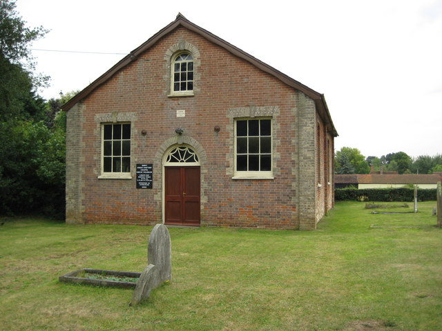
Image: © Nigel Cox Taken: 24 Aug 2009
The Chapel was built in 1867 and is on the south side of Toppesfield Road just to the west of its junction with the A1017. Lord's Day Service times are at 10.30 am, 2.15 pm or 6.30 pm. (From a cartographic viewpoint this submission shows how the locations of symbols showing features on the 1:50,000 scale Ordnance Survey mapping are moved away from their true positions in order to be visible and fit the other detail shown on the map. Here the cross symbol for the chapel on this mapping is at TL 7612 3782 whereas the true location from the larger scale 1:10,000 mapping is at TL 7615 3789 some 30 metres further east and 70 metres further north.)
Images are licensed for reuse under creativecommons.org/licenses/by-sa/2.0
Image Location
Latitude
52.011482
Longitude
0.565271