Bournemouth: the Red Arrows go upwards
Introduction
The photograph on this page of Bournemouth: the Red Arrows go upwards by Chris Downer as part of the Geograph project.
The Geograph project started in 2005 with the aim of publishing, organising and preserving representative images for every square kilometre of Great Britain, Ireland and the Isle of Man.

There are currently over 7.5m images from over 14,400 individuals and you can help contribute to the project by visiting https://www.geograph.org.uk
Bournemouth: the Red Arrows go upwards
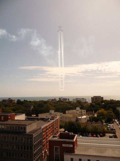
Image: © Chris Downer Taken: 21 Aug 2009
The Red Arrows take a dramatic course, high above Poole Bay off Bournemouth beach. They are doing their display as part of the free Bournemouth Air Show, a four-day extravaganza of all things aviation, from war planes to wing walkers. The Red Arrows are a perpetual favourite. In the foreground, we see the tops of Bournemouth House (left) and its neighbour in Christchurch Road, with properties of Gervis and Grove Roads and the Overcliff Drive between them and the sea.
Images are licensed for reuse under creativecommons.org/licenses/by-sa/2.0
Image Location
Latitude
50.720615
Longitude
-1.862964