Windvane on Countess Wear House
Introduction
The photograph on this page of Windvane on Countess Wear House by David Smith as part of the Geograph project.
The Geograph project started in 2005 with the aim of publishing, organising and preserving representative images for every square kilometre of Great Britain, Ireland and the Isle of Man.

There are currently over 7.5m images from over 14,400 individuals and you can help contribute to the project by visiting https://www.geograph.org.uk
Windvane on Countess Wear House
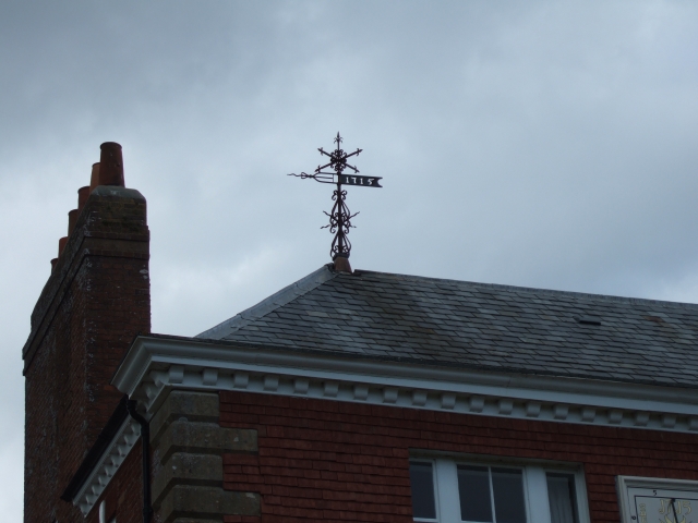
Image: © David Smith Taken: 20 Aug 2009
Like the sundial (Image]) this is dated 1715. Cherry and Pevsner have little to say about the building: "appears to be a substantial late C18 house revamped c.1900" and in the process give it the wrong house number. It is grade II listed, and the listing mentions that it was built circa 1770 and revammped in the Queen Anne Style in 1889. Why the date of 1715?
Images are licensed for reuse under creativecommons.org/licenses/by-sa/2.0
Image Location
Latitude
50.697299
Longitude
-3.498695