Aylesbury Arm: Bridge No 13 from the north
Introduction
The photograph on this page of Aylesbury Arm: Bridge No 13 from the north by Chris Reynolds as part of the Geograph project.
The Geograph project started in 2005 with the aim of publishing, organising and preserving representative images for every square kilometre of Great Britain, Ireland and the Isle of Man.

There are currently over 7.5m images from over 14,400 individuals and you can help contribute to the project by visiting https://www.geograph.org.uk
Aylesbury Arm: Bridge No 13 from the north
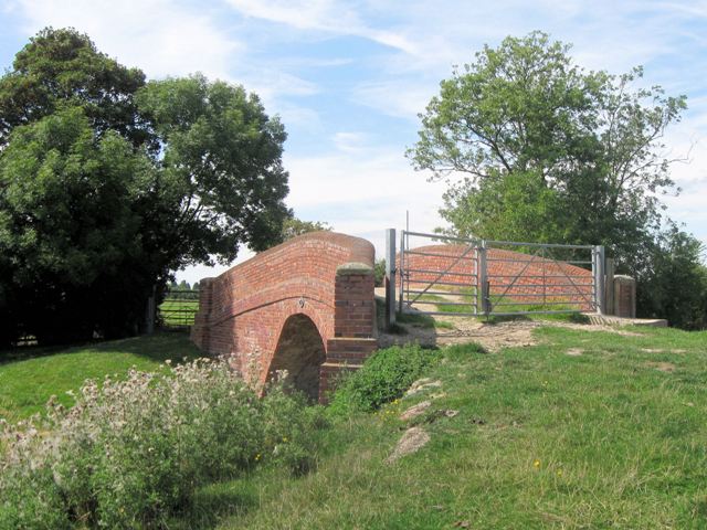
Image: © Chris Reynolds Taken: 16 Aug 2009
While the bridge is built at an angle it would have been too expensive to angle it along the line of the original track so it is necessary to make a definite turn in the direction of the photographer after crossing the bridge. To the west there is a large field of uniproved pasture Image Travel over the bridge towards Broughton: Image Looking in the opposite direction (see Image taken by David Hawgood in May 2 years earlier) and passing through the gateway there is an apparent choice of ways. The old trackway towards Puttenham runs between hedgerows Image while it is clear that farm vehicles (and probably most walkers) take a route nearer the canal Image See Image and Image
Images are licensed for reuse under creativecommons.org/licenses/by-sa/2.0
Image Location
Latitude
51.820404
Longitude
-0.766596