Aylesbury Arm: Canal Bridge No 13
Introduction
The photograph on this page of Aylesbury Arm: Canal Bridge No 13 by Chris Reynolds as part of the Geograph project.
The Geograph project started in 2005 with the aim of publishing, organising and preserving representative images for every square kilometre of Great Britain, Ireland and the Isle of Man.

There are currently over 7.5m images from over 14,400 individuals and you can help contribute to the project by visiting https://www.geograph.org.uk
Aylesbury Arm: Canal Bridge No 13
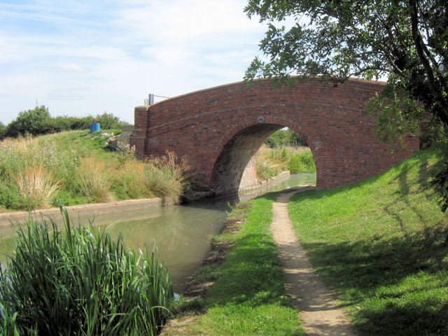
Image: © Chris Reynolds Taken: 16 Aug 2009
Bridge No 13 is currently used for farm access across the Aylesbury Arm of the Grand Union Canal and also carries a bridleway. The bridge crosses the canal at an angle, which is unusual for a farm bridge – suggesting a more significant history – and an examination of the surrounding landscape suggest it carried an ancient greenway from Oak Farm, Broughton, towards Rectory Farm, Puttenham. Image Travel along the canal to the West: Image Image Image Image Image Image Image Image Image Image Image Travel along the canal to the East: Image Travel along the track towards Broughton: Image Travel along the track towards Puttenham: Image
Images are licensed for reuse under creativecommons.org/licenses/by-sa/2.0
Image Location
Latitude
51.820404
Longitude
-0.766596