Dalry and North Johnstone Line
Introduction
The photograph on this page of Dalry and North Johnstone Line by Richard Webb as part of the Geograph project.
The Geograph project started in 2005 with the aim of publishing, organising and preserving representative images for every square kilometre of Great Britain, Ireland and the Isle of Man.

There are currently over 7.5m images from over 14,400 individuals and you can help contribute to the project by visiting https://www.geograph.org.uk
Dalry and North Johnstone Line
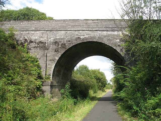
Image: © Richard Webb Taken: 13 Aug 2009
Bridge over a disused railway built in an era when the current line between Paisley and Ayrshire could not cope with the volume of freight needing shifting. This relief line on the west side of the lochs was closed to passengers in 1966 and freight shortly afterwards. I have a 1:50 000 map with a small length still marked - northwards to Kilbirnie. Now it is a very popular cycle path - part of National Cycle Route 7 which takes a circuitous route between Carlisle and Glasgow via Galloway. The railway looping around the opposite side of the lochs from the original line is also known as the Kilbarchan Loop, or Lochwinnoch Loop. The bridge carries a minor road over one of the many cuttings. The bridge uses concrete, the railway being built around 1905.
Images are licensed for reuse under creativecommons.org/licenses/by-sa/2.0
Image Location
Latitude
55.778125
Longitude
-4.651513