Former Church House, Belfast (13)
Introduction
The photograph on this page of Former Church House, Belfast (13) by Albert Bridge as part of the Geograph project.
The Geograph project started in 2005 with the aim of publishing, organising and preserving representative images for every square kilometre of Great Britain, Ireland and the Isle of Man.

There are currently over 7.5m images from over 14,400 individuals and you can help contribute to the project by visiting https://www.geograph.org.uk
Former Church House, Belfast (13)
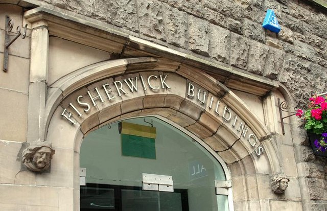
Image: © Albert Bridge Taken: 9 Aug 2009
See Image The entrance from Upper Queen Street. For a closer view of the head on the right see Image
Images are licensed for reuse under creativecommons.org/licenses/by-sa/2.0
Image Location
Latitude
54.596202
Longitude
-5.932915