Castle Carrock Beck, at the Waterworks
Introduction
The photograph on this page of Castle Carrock Beck, at the Waterworks by Rose and Trev Clough as part of the Geograph project.
The Geograph project started in 2005 with the aim of publishing, organising and preserving representative images for every square kilometre of Great Britain, Ireland and the Isle of Man.

There are currently over 7.5m images from over 14,400 individuals and you can help contribute to the project by visiting https://www.geograph.org.uk
Castle Carrock Beck, at the Waterworks
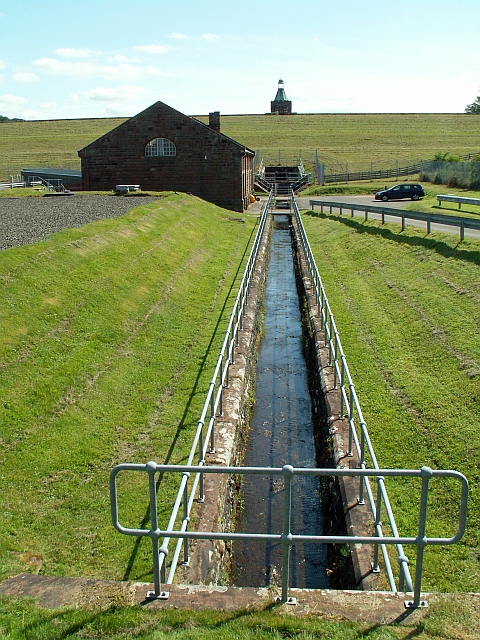
Image: © Rose and Trev Clough Taken: 11 Jul 2009
The beck has been culverted around the east side of Castle Carrock reservoir - see http://www.geograph.org.uk/photo/1433223 . It emerges behind the dam and is channelled through the water treatment works, after which it continues naturally downstream to join the River Gelt. The grassed slope of the reservoir dam is seen in the distance, with the top of the valve tower http://www.geograph.org.uk/photo/1433206 peeping over the top. (Photo taken on a guided tour of the works, which is not normally open to the public).
Images are licensed for reuse under creativecommons.org/licenses/by-sa/2.0
Image Location
Latitude
54.888289
Longitude
-2.711143