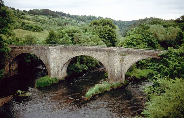
Clydesholm Bridge
Introduction
The photograph on this page of Clydesholm Bridge by Derek Harper as part of the Geograph project.
The Geograph project started in 2005 with the aim of publishing, organising and preserving representative images for every square kilometre of Great Britain, Ireland and the Isle of Man.
There are currently over 7.5m images from over 14,400 individuals and you can help contribute to the project by visiting https://www.geograph.org.uk

Image: © Derek Harper Taken: 5 Jul 2005
Rather similar to Image, but a summer view, albeit on a gloomy day. "A narrow, three-arched bridge of squared masonry spanning a deep valley. In good condition, approximately 4.0m wide, with cut-waters up- and down-stream" http://canmore.rcahms.gov.uk/en/site/46603/details/kirkfieldbank+clydesholm+bridge/ . "Until 1959 the A72 road crossed the Clyde near Lanark via the Clydesholm Bridge, built in 1699. Despite plans being drawn up in the mid-1800's it was never modified. The approach road was notorious for frequent fatal accidents. In 1956 Lanarkshire County Council decided to budget £135000 for a new bridge 110 yards downstream" www.scran.ac.uk/000-000-590-430-C . It is from this later bridge that the photo is taken.

