Eckington - United Methodist Free Church
Introduction
The photograph on this page of Eckington - United Methodist Free Church by Dave Bevis as part of the Geograph project.
The Geograph project started in 2005 with the aim of publishing, organising and preserving representative images for every square kilometre of Great Britain, Ireland and the Isle of Man.

There are currently over 7.5m images from over 14,400 individuals and you can help contribute to the project by visiting https://www.geograph.org.uk
Eckington - United Methodist Free Church
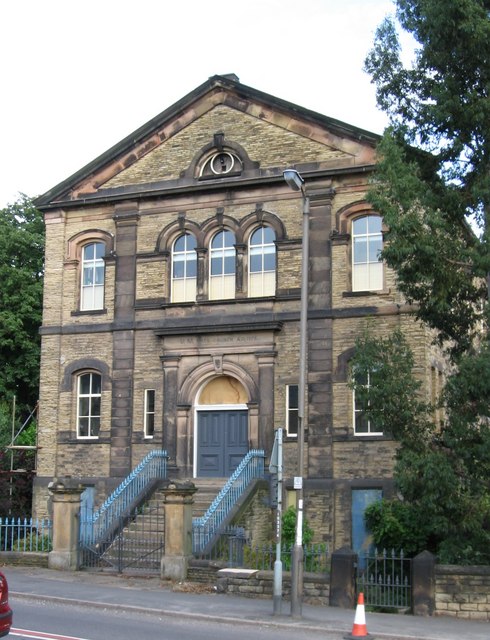
Image: © Dave Bevis Taken: 24 Jul 2009
On High Street. A more distant view is available at Image The following additional information has been provided by Andrew Tatlow (http://www.geograph.org.uk/profile/5589). This is no longer a Methodist Chapel. Known to Andrew Tatlow as Trinity but he is not sure where that name came from! Trinity closed 15 to 20 years ago and operations were moved to another chapel at the top end of the village on Chesterfield Road. Probably closed 1994 because in the National Archives 2006 Accessions includes an entry "United Methodist Free Chapel, Eckington: records incl minutes and baptism registers 1921-1994 (NR)"
Images are licensed for reuse under creativecommons.org/licenses/by-sa/2.0
Image Location
Latitude
53.308571
Longitude
-1.361233