Field and view, Ivybridge
Introduction
The photograph on this page of Field and view, Ivybridge by Derek Harper as part of the Geograph project.
The Geograph project started in 2005 with the aim of publishing, organising and preserving representative images for every square kilometre of Great Britain, Ireland and the Isle of Man.

There are currently over 7.5m images from over 14,400 individuals and you can help contribute to the project by visiting https://www.geograph.org.uk
Field and view, Ivybridge
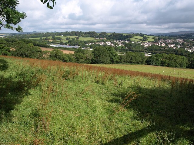
Image: © Derek Harper Taken: 23 Jul 2009
Sorrel browns a steep field by the lane from Ivybridge up to Marjery Cross, with a line of mature trees following a small stream down the far side. Beyond, left of centre, is Image To the right, across the A38, are the western suburbs of Ivybridge around Cornwood Road, with a glimpse of Dartmoor beyond.
Images are licensed for reuse under creativecommons.org/licenses/by-sa/2.0
Image Location


Leaflet Map data © OpenStreetMap
Latitude
50.384147
Longitude
-3.93682