Church Street
Introduction
The photograph on this page of Church Street by Simon Carey as part of the Geograph project.
The Geograph project started in 2005 with the aim of publishing, organising and preserving representative images for every square kilometre of Great Britain, Ireland and the Isle of Man.

There are currently over 7.5m images from over 14,400 individuals and you can help contribute to the project by visiting https://www.geograph.org.uk
Church Street
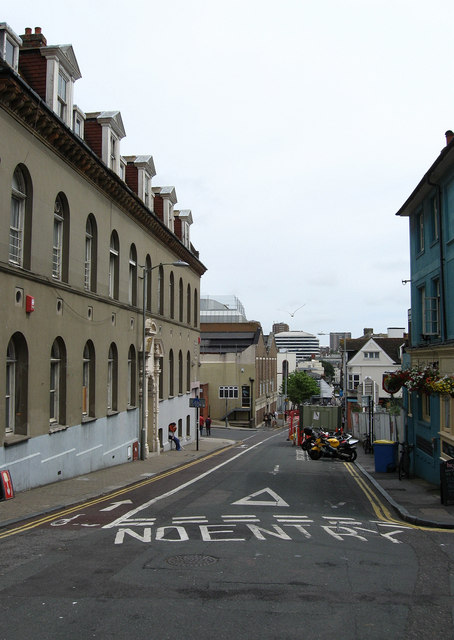
Image: © Simon Carey Taken: 20 Jul 2009
Originally a path between the laines, the name given to small strips of fields that lay to the north of the original town of Brighton, known as North Back Side. It was given its current name in 1792 and climbs the hill from Old Steine to St Nicholas' church. Taken from the junction with Windsor Street the building on the left is the former drill hall built in 1889 for the Royal Sussex Regiment but now part of the Royal Mail sorting offices. Beyond is the junction with Spring Gardens.
Images are licensed for reuse under creativecommons.org/licenses/by-sa/2.0
Image Location
Latitude
50.824875
Longitude
-0.14187