582 & 584 Lordship Lane, London N22
Introduction
The photograph on this page of 582 & 584 Lordship Lane, London N22 by Arb as part of the Geograph project.
The Geograph project started in 2005 with the aim of publishing, organising and preserving representative images for every square kilometre of Great Britain, Ireland and the Isle of Man.

There are currently over 7.5m images from over 14,400 individuals and you can help contribute to the project by visiting https://www.geograph.org.uk
582 & 584 Lordship Lane, London N22
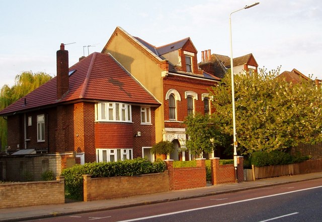
Image: © Arb Taken: 3 Apr 2006
The 1950's style house grafted onto the end of a truncated Victorian terrace is a consequence of the only significant bomb strike on Lordship Lane during World War 2.
Images are licensed for reuse under creativecommons.org/licenses/by-sa/2.0
Image Location
Latitude
51.59936
Longitude
-0.098416