View Near Anstiebury Farm, Coldharbour, Surrey
Introduction
The photograph on this page of View Near Anstiebury Farm, Coldharbour, Surrey by Peter Trimming as part of the Geograph project.
The Geograph project started in 2005 with the aim of publishing, organising and preserving representative images for every square kilometre of Great Britain, Ireland and the Isle of Man.

There are currently over 7.5m images from over 14,400 individuals and you can help contribute to the project by visiting https://www.geograph.org.uk
View Near Anstiebury Farm, Coldharbour, Surrey
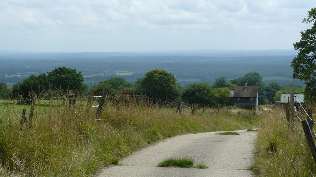
Image: © Peter Trimming Taken: 16 Jul 2009
Looking towards the east, with some of the farm buildings visible to the right of picture. I first discovered this view, just off Anstie Lane, in 1994, in the days when I was riding a mountain bike (before I discovered that road bikes were faster, and fun to race!). On that fateful day, I admired this view before setting off for a fast, first time descent of Anstie Lane. Having checked the map, I successfully negotiated the single arrow hill followed by 90 degree bend, but further down the hill, I hit some gravel, locked up my wheels, and finished up in a hedge! Luckily, nothing was broken, and, since no-one was around to see, it didn't happen ...
Images are licensed for reuse under creativecommons.org/licenses/by-sa/2.0
Image Location
Latitude
51.185386
Longitude
-0.343623