The Mound of Down
Introduction
The photograph on this page of The Mound of Down by John Martin as part of the Geograph project.
The Geograph project started in 2005 with the aim of publishing, organising and preserving representative images for every square kilometre of Great Britain, Ireland and the Isle of Man.

There are currently over 7.5m images from over 14,400 individuals and you can help contribute to the project by visiting https://www.geograph.org.uk
The Mound of Down
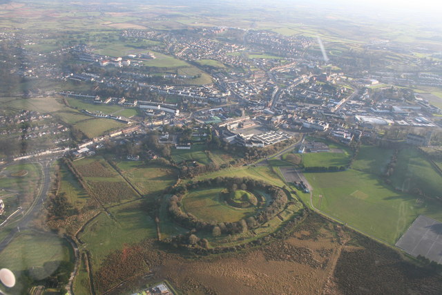
Image: © John Martin Taken: 30 Nov 2008
The Mound of Down is an Iron Age hill fort which had a Norman motte built within the ring earthwork. An aerial photo from helicopter.
Images are licensed for reuse under creativecommons.org/licenses/by-sa/2.0
Image Location
Latitude
54.332339
Longitude
-5.720317