Meir Heath windmill
Introduction
The photograph on this page of Meir Heath windmill by Richard Law as part of the Geograph project.
The Geograph project started in 2005 with the aim of publishing, organising and preserving representative images for every square kilometre of Great Britain, Ireland and the Isle of Man.

There are currently over 7.5m images from over 14,400 individuals and you can help contribute to the project by visiting https://www.geograph.org.uk
Meir Heath windmill
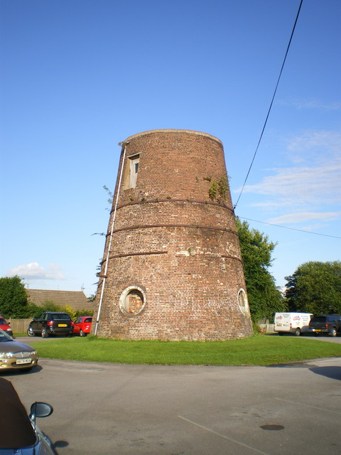
Image: © Richard Law Taken: 15 Jul 2009
The shell of this windmill was rescued and stabilised from a dilapidated state in 2002, when the concrete cap was repaired and the iron bands around the brickwork were restored. A local group was formed at that time to try and look after it. The mill stands in the carpark of a pub called, with great imagination, The Windmill.
Images are licensed for reuse under creativecommons.org/licenses/by-sa/2.0
Image Location
Latitude
52.957685
Longitude
-2.106095