St Albans: Paxton Street
Introduction
The photograph on this page of St Albans: Paxton Street by Nigel Cox as part of the Geograph project.
The Geograph project started in 2005 with the aim of publishing, organising and preserving representative images for every square kilometre of Great Britain, Ireland and the Isle of Man.

There are currently over 7.5m images from over 14,400 individuals and you can help contribute to the project by visiting https://www.geograph.org.uk
St Albans: Paxton Street
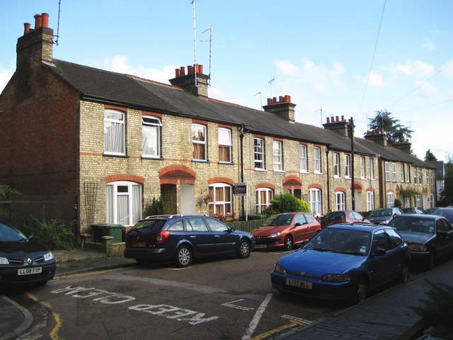
Image: © Nigel Cox Taken: 6 Jul 2009
Backland development may be regarded as a modern phenomenon, but Paxton Street is a circa 1900 example, where the four sides of the area that currently contains the houses were already developed. This is the terrace at the end of the street at the rear of Image Indeed the out of sight rear north-east corner of the nearest house in the terrace would have been very close, if not touching, the south-west corner of the original 1908 built Alpha Picture Palace, one of the first cinemas in the country.
Images are licensed for reuse under creativecommons.org/licenses/by-sa/2.0
Image Location


Leaflet Map data © OpenStreetMap
Latitude
51.747524
Longitude
-0.332703