Ashton Moss Curve
Introduction
The photograph on this page of Ashton Moss Curve by Peter Whatley as part of the Geograph project.
The Geograph project started in 2005 with the aim of publishing, organising and preserving representative images for every square kilometre of Great Britain, Ireland and the Isle of Man.

There are currently over 7.5m images from over 14,400 individuals and you can help contribute to the project by visiting https://www.geograph.org.uk
Ashton Moss Curve
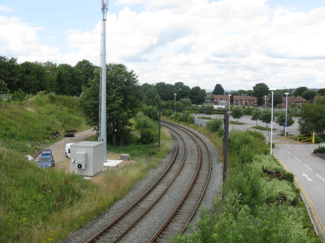
Image: © Peter Whatley Taken: 13 Jul 2009
The railway line curves sharply between the site of the former Ashton Moss South Junction (now obliterated) and the main Manchester-Ashton line. Just visible are electrification masts for this distant offshoot of the 1950s Manchester-Sheffield-Wath electrification scheme.
Images are licensed for reuse under creativecommons.org/licenses/by-sa/2.0
Image Location
Latitude
53.491439
Longitude
-2.108631