Ammunition access tunnel, High Angle Battery
Introduction
The photograph on this page of Ammunition access tunnel, High Angle Battery by John Goldsmith as part of the Geograph project.
The Geograph project started in 2005 with the aim of publishing, organising and preserving representative images for every square kilometre of Great Britain, Ireland and the Isle of Man.

There are currently over 7.5m images from over 14,400 individuals and you can help contribute to the project by visiting https://www.geograph.org.uk
Ammunition access tunnel, High Angle Battery
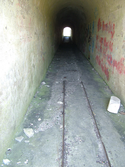
Image: © John Goldsmith Taken: 5 Jul 2009
The ammunition for the High Angle Battery (See Image) was stored underground, with a narrow gauge railway running down this tunnel, which then has side branches into the stone hillside.
Images are licensed for reuse under creativecommons.org/licenses/by-sa/2.0
Image Location
Latitude
50.558563
Longitude
-2.431935