Bainbridge Institute
Introduction
The photograph on this page of Bainbridge Institute by David Pickersgill as part of the Geograph project.
The Geograph project started in 2005 with the aim of publishing, organising and preserving representative images for every square kilometre of Great Britain, Ireland and the Isle of Man.

There are currently over 7.5m images from over 14,400 individuals and you can help contribute to the project by visiting https://www.geograph.org.uk
Bainbridge Institute
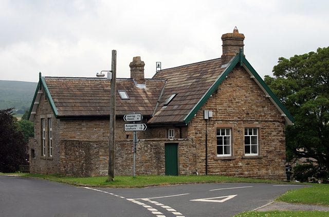
Image: © David Pickersgill Taken: 27 Jun 2009
The style and date (1875) of the building strongly suggests it was built as a school, probably as a result of the 1870 Education Act which allowed local school boards to raise money from the rates to fund elementary education. If that's not enough, the name of the road running off to its right, School Hill, clinches the argument!
Images are licensed for reuse under creativecommons.org/licenses/by-sa/2.0
Image Location
Latitude
54.306368
Longitude
-2.103855