Farnborough: The Tumble Down Dick Hotel
Introduction
The photograph on this page of Farnborough: The Tumble Down Dick Hotel by Nigel Cox as part of the Geograph project.
The Geograph project started in 2005 with the aim of publishing, organising and preserving representative images for every square kilometre of Great Britain, Ireland and the Isle of Man.

There are currently over 7.5m images from over 14,400 individuals and you can help contribute to the project by visiting https://www.geograph.org.uk
Farnborough: The Tumble Down Dick Hotel
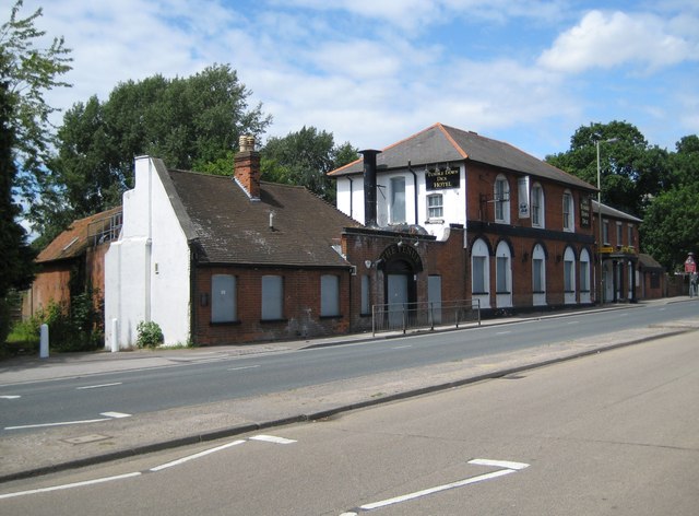
Image: © Nigel Cox Taken: 3 Jul 2009
When I first saw this hotel I thought the name must have been one of those half-baked efforts at re-branding of the Slug and Lettuce variety, but no, this apparently has always been its name and the 1874 Ordnance Survey map proves it by showing it as "Tumbledown Dick (PH)". A walks guide describes it as possibly being built in the reign of King Henry VIII. It has two storeys, red brick walls, a slate roof and is partly tile hung. A story goes that it could have been named after the downfall of King Richard III or the downfall of Cromwell's Commonwealth which he had left in the hands of his son Richard Cromwell. There was also a turnpike toll gate across the road, although there is no longer any record of it here." Whatever, despite the white sign under the eaves stating that rooms are available, the place is boarded up and its fate uncertain. Judging by various postings on the internet it was up until recently a gig location for the goth scene. The dual carriageway in front of the building is the A325 Farnborough Road.
Images are licensed for reuse under creativecommons.org/licenses/by-sa/2.0
Image Location
Latitude
51.293073
Longitude
-0.753526