Little Polstreath
Introduction
The photograph on this page of Little Polstreath by Derek Harper as part of the Geograph project.
The Geograph project started in 2005 with the aim of publishing, organising and preserving representative images for every square kilometre of Great Britain, Ireland and the Isle of Man.

There are currently over 7.5m images from over 14,400 individuals and you can help contribute to the project by visiting https://www.geograph.org.uk
Little Polstreath
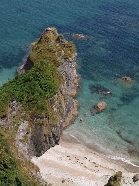
Image: © Derek Harper Taken: 3 Jul 2009
The small beach is separated from Polstreath to the north by what appears, from this angle, to be a single headland. As Image shows, the further, less vegetated part is a separate stack. That water does look tempting, but it is about 70 metres below.
Images are licensed for reuse under creativecommons.org/licenses/by-sa/2.0
Image Location
Latitude
50.273664
Longitude
-4.783976