Fields south of Lower Burrowton
Introduction
The photograph on this page of Fields south of Lower Burrowton by Derek Harper as part of the Geograph project.
The Geograph project started in 2005 with the aim of publishing, organising and preserving representative images for every square kilometre of Great Britain, Ireland and the Isle of Man.

There are currently over 7.5m images from over 14,400 individuals and you can help contribute to the project by visiting https://www.geograph.org.uk
Fields south of Lower Burrowton
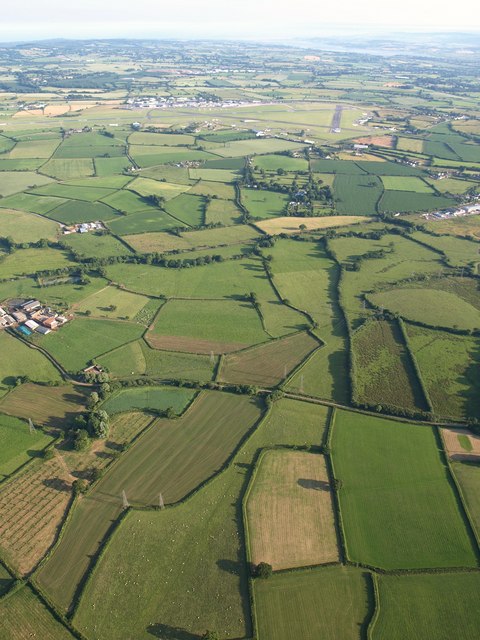
Image: © Derek Harper Taken: 1 Jul 2009
The fields in the foreground, some of unusual shape, are dropping down a slope towards the Rockbeare Stream, which follows a winding tree-lined course close to the railway line across the image just beyond Elbury Farm (see Image) on the left. Further away is Exeter Airport. View from a hot air balloon.
Images are licensed for reuse under creativecommons.org/licenses/by-sa/2.0
Image Location
Latitude
50.753156
Longitude
-3.418963