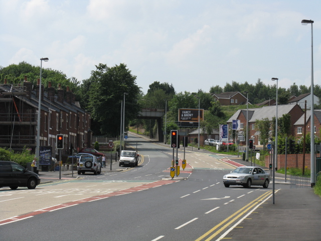
Manchester's Old Ring Road
Introduction
The photograph on this page of Manchester's Old Ring Road by Peter Whatley as part of the Geograph project.
The Geograph project started in 2005 with the aim of publishing, organising and preserving representative images for every square kilometre of Great Britain, Ireland and the Isle of Man.
There are currently over 7.5m images from over 14,400 individuals and you can help contribute to the project by visiting https://www.geograph.org.uk

Image: © Peter Whatley Taken: 1 Jul 2009
Before Manchester wisely invested in motorways, this was the principal route around Manchester's northern suburbs. In that era, it was only as wide as the section visible under the bridge, at which point a short, severe slope rises to the main Bolton road. Hugely unfunny with nose to tail traffic of all sizes and shapes, all with rather less powerful brakes and engines than today.

