Dumbarton Rock: The Governor's House
Introduction
The photograph on this page of Dumbarton Rock: The Governor's House by Lairich Rig as part of the Geograph project.
The Geograph project started in 2005 with the aim of publishing, organising and preserving representative images for every square kilometre of Great Britain, Ireland and the Isle of Man.

There are currently over 7.5m images from over 14,400 individuals and you can help contribute to the project by visiting https://www.geograph.org.uk
Dumbarton Rock: The Governor's House
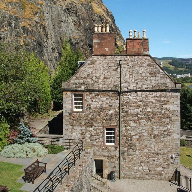
Image: © Lairich Rig Taken: 26 Jun 2009
[This is one of a linked series of articles about Dumbarton Rock. See the end of http://www.geograph.org.uk/photo/1380091 for a list of the reference works that are cited here in abbreviated form.] The building shown here serves as a ticket office for Dumbarton Castle, and as a museum. Like King George's Battery, the Governor's House was built in 1735 (John, 8th Earl of Cassillis, was the governor of the castle at that time) [MacPhail, p144]. The house was built upon the site of the medieval gatehouse, which had likewise housed the governors of the castle from early times [OSG92, p11]. Little is known about the history of occupation and fortification on the Rock between the sacking of a fortress here by Viking forces in 870 and the building of the first medieval castle. However, among the exhibits on display in the Governor's House are fragments of two tenth-century recumbent cross-slabs (Image). They were found in the lower slopes just behind the house, an area that is the traditional location of an early chapel of St Patrick; the fragments may have been associated with that chapel, or they may have brought from elsewhere [HD, p11, 18, 73]. Previous: Image Next: Image
Images are licensed for reuse under creativecommons.org/licenses/by-sa/2.0
Image Location
Latitude
55.936132
Longitude
-4.562861