Bench mark on the triangulation pillar, Ned Lane Tong
Introduction
The photograph on this page of Bench mark on the triangulation pillar, Ned Lane Tong by Humphrey Bolton as part of the Geograph project.
The Geograph project started in 2005 with the aim of publishing, organising and preserving representative images for every square kilometre of Great Britain, Ireland and the Isle of Man.

There are currently over 7.5m images from over 14,400 individuals and you can help contribute to the project by visiting https://www.geograph.org.uk
Bench mark on the triangulation pillar, Ned Lane Tong
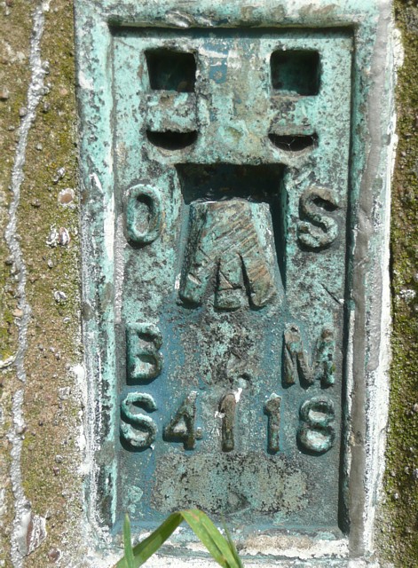
Image: © Humphrey Bolton Taken: 18 Jun 2009
Whereas the theodolite would be placed on the top of the pillar, the height of the station is that of the bench-mark lower down. The plate, known as a flush bracket, bears the number S4118. All (but one) trig pillars have a flush bracket with a unique number. The level 185.70m. See http://www.haroldstreet.org.uk/trigpoints/trig-bagging.php?area=SE .
Images are licensed for reuse under creativecommons.org/licenses/by-sa/2.0
Image Location
Latitude
53.782158
Longitude
-1.702512