Winterborne Muston, River Winterborne
Introduction
The photograph on this page of Winterborne Muston, River Winterborne by Mike Faherty as part of the Geograph project.
The Geograph project started in 2005 with the aim of publishing, organising and preserving representative images for every square kilometre of Great Britain, Ireland and the Isle of Man.

There are currently over 7.5m images from over 14,400 individuals and you can help contribute to the project by visiting https://www.geograph.org.uk
Winterborne Muston, River Winterborne
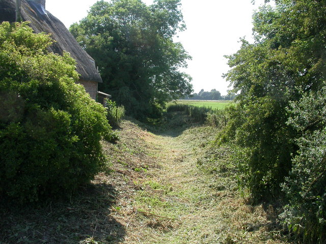
Image: © Mike Faherty Taken: 27 Jun 2009
One of two Dorset rivers bearing this name, this is the North Winterborne. Winterbornes flow in winter, fed by aquifers, and often dry out in summer. They can often be distinguished by the aquatic or marginal vegetation growing in their dry beds in the summer. Here, the river is invisible. To the left, Bridge Cottage. Interestingly, OS shows this location as a ford, whereas it is a bridge. http://www.england-in-particular.info/stour/s-winterborne.html
Images are licensed for reuse under creativecommons.org/licenses/by-sa/2.0
Image Location
Latitude
50.777205
Longitude
-2.183192