Site of the old Weston Airport
Introduction
The photograph on this page of Site of the old Weston Airport by Ant Basterfield as part of the Geograph project.
The Geograph project started in 2005 with the aim of publishing, organising and preserving representative images for every square kilometre of Great Britain, Ireland and the Isle of Man.

There are currently over 7.5m images from over 14,400 individuals and you can help contribute to the project by visiting https://www.geograph.org.uk
Site of the old Weston Airport
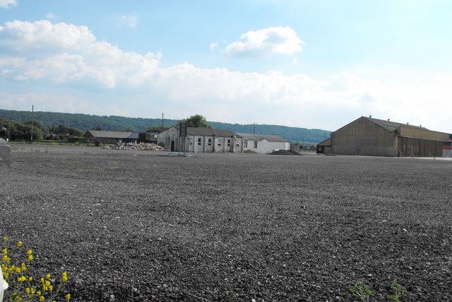
Image: © Ant Basterfield Taken: 23 Jun 2009
Here is the site of where Weston Airport first started (some of the wooden buildings were cleared about five years ago) though the ever present M.O.D brick and render building can be seen. These would have been erected early in its RAF period though I suspect the maintenance hangar to the right is probably older. See this link for views of some of the buildings that went and some that still cling on http://www.controltowers.co.uk/W-Z/Weston_Super_Mare.htm
Images are licensed for reuse under creativecommons.org/licenses/by-sa/2.0
Image Location
Latitude
51.339089
Longitude
-2.929058