The new Newry bypass (59)
Introduction
The photograph on this page of The new Newry bypass (59) by Albert Bridge as part of the Geograph project.
The Geograph project started in 2005 with the aim of publishing, organising and preserving representative images for every square kilometre of Great Britain, Ireland and the Isle of Man.

There are currently over 7.5m images from over 14,400 individuals and you can help contribute to the project by visiting https://www.geograph.org.uk
The new Newry bypass (59)
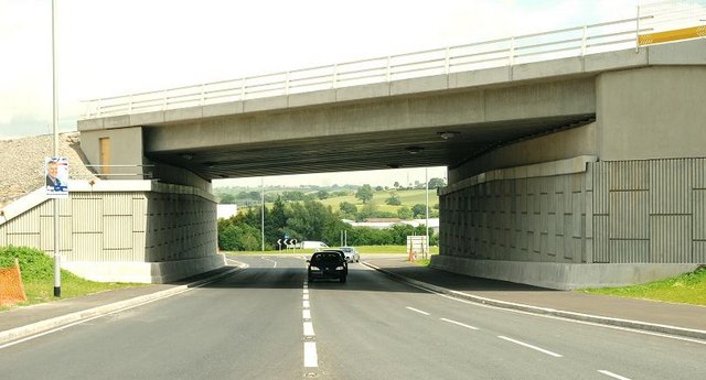
Image: © Albert Bridge Taken: 13 Jun 2009
See Image The Tanderagee and Armagh Roads will be served by a grade-separated junction at Carnbane, close to the Tanderagee Road. The Carnbane Road Image has been rebuilt, on a new line, between this new flyover and the Tanderagee Road (background). The flyover is approximately on the site of the closed (1965) GNR(I) line from Goraghwood to Newry and Warrenpoint. Continue to Image
Images are licensed for reuse under creativecommons.org/licenses/by-sa/2.0
Image Location
Latitude
54.202723
Longitude
-6.35799