The new Newry bypass (54)
Introduction
The photograph on this page of The new Newry bypass (54) by Albert Bridge as part of the Geograph project.
The Geograph project started in 2005 with the aim of publishing, organising and preserving representative images for every square kilometre of Great Britain, Ireland and the Isle of Man.

There are currently over 7.5m images from over 14,400 individuals and you can help contribute to the project by visiting https://www.geograph.org.uk
The new Newry bypass (54)
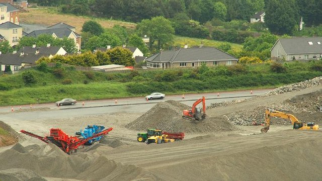
Image: © Albert Bridge Taken: 13 Jun 2009
See Image Part of the new road, to the north of the Cloghoge roundabout Image is being built through rock. Blasting takes place most weeks with the road closed for around 30 minutes. Blasting is timed so as not to coincide with passing trains Image on the parallel railway. What, I think, is happening here (if anyone has a definitive version then please let me know) is that rock recovered from the blasting is being crushed for use as fill. The existing (single carriageway) bypass runs across the middle of the photo). Continue to Image
Images are licensed for reuse under creativecommons.org/licenses/by-sa/2.0
Image Location
Latitude
54.15647
Longitude
-6.35278