Floods in Sheffield
Introduction
The photograph on this page of Floods in Sheffield by Dave Pickersgill as part of the Geograph project.
The Geograph project started in 2005 with the aim of publishing, organising and preserving representative images for every square kilometre of Great Britain, Ireland and the Isle of Man.

There are currently over 7.5m images from over 14,400 individuals and you can help contribute to the project by visiting https://www.geograph.org.uk
Floods in Sheffield
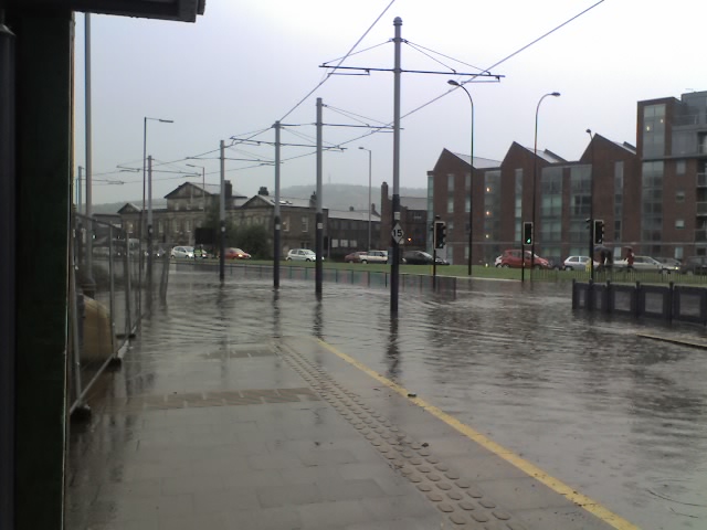
Image: © Dave Pickersgill Taken: 10 Jun 2009
This photograph was taken approx. 17:30 on Wednesday 10th.June 2009 at the height of flash floods in Sheffield. The photographer is under the shelter at the Shalesmoor tram stop. The yellow line is the edge of the platform, this normally has a drop of some 18 inches to the tram track below. In the distance is Penistone Road. Traffic is flowing towards the city centre. However, due to flooding there is no traffic flowing in the opposite direction.
Images are licensed for reuse under creativecommons.org/licenses/by-sa/2.0
Image Location
Latitude
53.389134
Longitude
-1.477009