Folly?
Introduction
The photograph on this page of Folly? by Stuart Wilding as part of the Geograph project.
The Geograph project started in 2005 with the aim of publishing, organising and preserving representative images for every square kilometre of Great Britain, Ireland and the Isle of Man.

There are currently over 7.5m images from over 14,400 individuals and you can help contribute to the project by visiting https://www.geograph.org.uk
Folly?
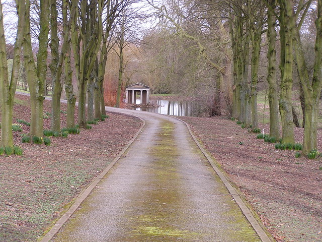
Image: © Stuart Wilding Taken: 10 Mar 2006
This appears to be a small roman temple(?) situated in a small lake. If that's not a folly.....? It appeared to be in the grounds of a house with four large doric columns and little else. (I really need to do more research)
Images are licensed for reuse under creativecommons.org/licenses/by-sa/2.0
Image Location
Latitude
51.846916
Longitude
-2.682239