Fore Street Lifton
Introduction
The photograph on this page of Fore Street Lifton by Sarah Smith as part of the Geograph project.
The Geograph project started in 2005 with the aim of publishing, organising and preserving representative images for every square kilometre of Great Britain, Ireland and the Isle of Man.

There are currently over 7.5m images from over 14,400 individuals and you can help contribute to the project by visiting https://www.geograph.org.uk
Fore Street Lifton
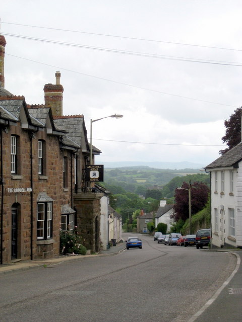
Image: © Sarah Smith Taken: 8 Jun 2009
Looking in an easterly direction down the street,the Arundell Arms Hotel, a former 18th century coaching inn, is on the left, now a well-known fishing pub. The village lies in the valley of the River Lyd not far from where it meets the River Tamar.
Images are licensed for reuse under creativecommons.org/licenses/by-sa/2.0
Image Location
Latitude
50.64318
Longitude
-4.283949