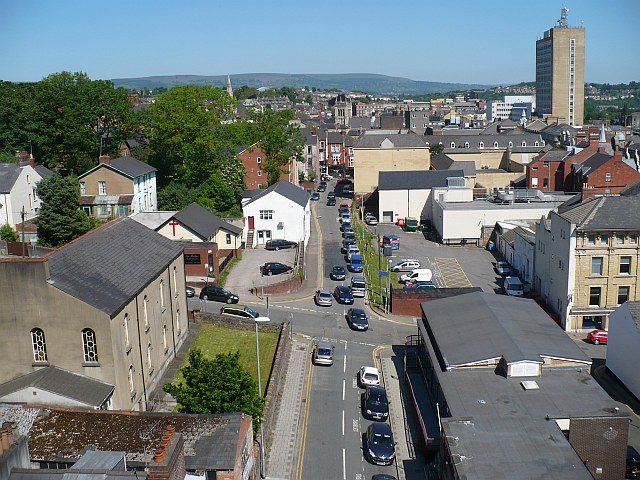
Ivor Street and Talbot Lane, Newport
Introduction
The photograph on this page of Ivor Street and Talbot Lane, Newport by Robin Drayton as part of the Geograph project.
The Geograph project started in 2005 with the aim of publishing, organising and preserving representative images for every square kilometre of Great Britain, Ireland and the Isle of Man.
There are currently over 7.5m images from over 14,400 individuals and you can help contribute to the project by visiting https://www.geograph.org.uk

Image: © Robin Drayton Taken: 1 Jun 2009
A view from the top of Park Square Multi-Storey Car Park. The grey roofed building in the foreground on the right belongs to the Salvation Army as does the small building with a red cross. On the left is Mynydd Seion a Welsh Independent chapel. The square tower in the centre in the distance belongs to St Mary's Roman Catholic Church in Stow Hill. The tall office block is the Chartist Tower and is currently the tallest building in Newport at 173 feet.

