West Thurrock Cement Industry, 1974
Introduction
The photograph on this page of West Thurrock Cement Industry, 1974 by Pierre Terre as part of the Geograph project.
The Geograph project started in 2005 with the aim of publishing, organising and preserving representative images for every square kilometre of Great Britain, Ireland and the Isle of Man.

There are currently over 7.5m images from over 14,400 individuals and you can help contribute to the project by visiting https://www.geograph.org.uk
West Thurrock Cement Industry, 1974
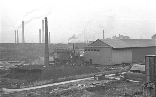
Image: © Pierre Terre Taken: 25 Feb 1974
Looking SE from Stonehouse Lane across cement works either side of the A282 Dartford Tunnel Approach road. In the foreground is the Lafarge works west of the A282
Images are licensed for reuse under creativecommons.org/licenses/by-sa/2.0
Image Location


Leaflet Map data © OpenStreetMap
Latitude
51.480887
Longitude
0.263881