Kings Langley: Chipperfield Road
Introduction
The photograph on this page of Kings Langley: Chipperfield Road by Nigel Cox as part of the Geograph project.
The Geograph project started in 2005 with the aim of publishing, organising and preserving representative images for every square kilometre of Great Britain, Ireland and the Isle of Man.

There are currently over 7.5m images from over 14,400 individuals and you can help contribute to the project by visiting https://www.geograph.org.uk
Kings Langley: Chipperfield Road
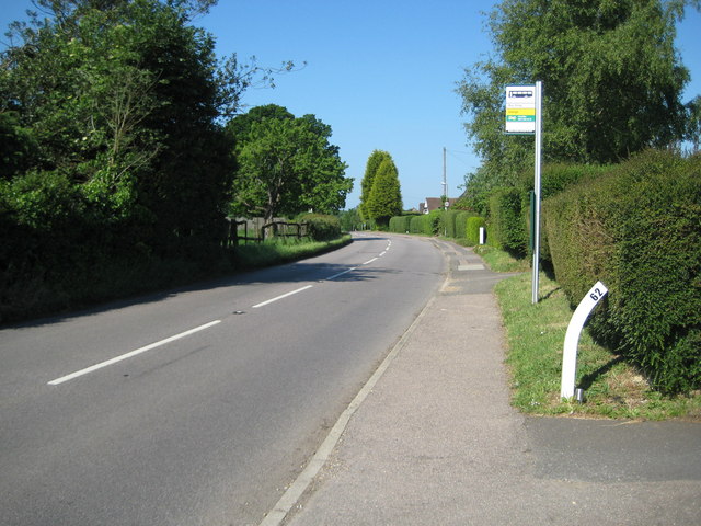
Image: © Nigel Cox Taken: 31 May 2009
This is Chipperfield Road looking in the direction of Chipperfield. The timetable on the bus stop indicates that the traveller would be in for a long wait, as there are only three buses a day, on Route R9, and none on Sundays. The Ordnance Survey 1:50,000 scale site mapping shows a spot height of 134 metres here. Curiously on the OS's larger scale maps it is a metre lower at 133 metres. Whatever, this is one, if not the, publicly accessible highest point in the parish of Kings Langley.
Images are licensed for reuse under creativecommons.org/licenses/by-sa/2.0
Image Location
Latitude
51.712684
Longitude
-0.468456